 NERC Data Catalogue Service
Seismic surveys
Type of resources
Topics
Keywords
Contact for the resource
Provided by
Years
Formats
Representation types
Update frequencies
Scale
-
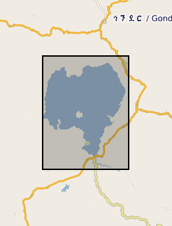
This is Seistec Boomer data acquired on Lake Tana. If not familiar with this variant of standard Boomer, it has a line-in-cone.
-
The Seismic Locations and Sections database (LOCSEC) stores digitised seismic reflection survey location and line-interpretation data. Supplementary data stored includes map projection information and rock-unit seismic velocity data. The data are grouped by interpretation project area. Location data are input from digitised seismic shotpoint (SP) or common depth point (CDP) maps, or from direct input of digital navigation data. [See: Original Seismic Shotpoint Location Maps (ORIGSPMAPS) and Digital Seismic Shotpoint Location Maps (DIGSPMAPS) datasets]. Line-interpretation data are input from digitised pick-lines on manually interpreted printed seismic sections. [See: Copy Seismic Sections dataset (COPYSEISECS)]. In-house software is used for data management and display, to perform interpretation related tasks, e.g. depth-conversion, and to merge data into X, Y, Z form for input to 3D mapping and modelling packages such as EarthVision. Data in LOCSEC may also be related to the borehole interpretations held in the Stratigraphic Surfaces Database (SSD). Almost all data are within the UK Onshore area; although there are some UK near-shore and offshore (North Sea, Irish Sea) and foreign data. Most data were acquired for commercial hydrocarbon exploration and subsequently provided to BGS for use on specific projects. Some data were acquired by BGS and other public-sector bodies, e.g. BIRPS, for academic research.
-

This document data set contains original prints, on paper, sepia or film, of seismic reflection survey location (navigation) maps. These provide the location data for the seismic sections of the Original Seismic Sections (ORIGSEISECS) and Copy Seismic Sections (COPYSEISECS) datasets. Almost all data are within the UK onshore area; although there are some UK near-shore and offshore (North Sea, Irish Sea) and foreign data. Most data were acquired for commercial hydrocarbon exploration and subsequently provided to BGS for use on specific projects. Some data were acquired by BGS and other public-sector bodies, e.g. BIRPS, for academic research. All maps are digitised upon receipt (see LOCSEC database) and then archived in this data set. (Copies used to be used for interpretation purposes but this is no longer the case.) Documents stored rolled in tubes. Approx 800 maps.
-
This dataset is an archive of the following original data for the seismic reflection surveys conducted by the BGS in Bangladesh for PetroBangla (Bangladesh state oil & gas company) and the UK Overseas Development Agency (funding body): Observers' logs, Surveyors' reports, Location data tapes, Field data recording tapes, Processed data tapes and various stages of processing: demultiplexed field data to migrated stack (not all available for all profiles). These data are kept as archive copies. They are only available with the agreement of PetroBangla and the ODA. Approx. written records and approx. 1200 tapes.
-
This document data set contains paper copies of many of the seismic reflection survey sections from the original seismic sections data set (ORIGSEISECS) . These have been made for interpretation. Most data are within the UK onshore area; although there are some UK near-shore and offshore (North Sea, Irish Sea) and foreign data. Most data were acquired for commercial hydrocarbon exploration and subsequently provided to BGS for use on specific projects. Some data were acquired by BGS and other public-sector bodies, e.g. BIRPS (British Institutes Reflection Profiling Syndicate ), for academic research. The documents are dyeline prints or plain-paper photocopies. They are stored folded in boxes, approx 40 sections per box, approx 530 boxes. There are a lot of duplicates, there being an interpreted and uninterpreted copy of many profiles. Mostly concentrated in areas prospective for coal, oil and gas.
-
This dataset contains the acquired distributed acoustic sensing (DAS) and hydrophone datasets from a project investigating the usage DAS at the UK Geoenergy Observatory (UKGEOS) research facility in Glasgow, funded by the UK Unconventional Hydrocarbons (UKUH) small project grant. The UKGEOS site in Glasgow has repurposed an abandoned coal mine to investigate its potential as a heat source and heat sink, and its borehole infrastructure includes pre-installed fibre-optic cables. DAS is a novel seismic monitoring technique that utilizes fibre-optic cables to measure small acoustic and seismic vibrations. Comparable to a very densely spaced hydrophone or geophone array, DAS provides unparalleled data resolution and insights into the subsurface. This dataset provides both active source and passive measurements of DAS at the UKGEOS Site 2 prior to the heat pump installation, providing geophysical baseline measurements of the mine. Alongside the acquired DAS data, data from a hydrophone array co-located to the fibre-optic cable was collected during the active source survey to provide a means of comparison to the DAS. NERC and ESRC jointly funded Unconventional Hydrocarbons in the UK Energy System Programme grant - Baseline seismic monitoring survey for UKGEOS Glasgow geothermal production using Distributed Acoustic Sensing (DAS)
-

The 3D multi channel seismic data were acquired as part of a collaborative investigation into models of magmatic segmentation between the Scripps Institute of Oceanography and BIRPS (the British Institutions Reflection Profiling Syndicate). The 3D EPR (East Pacific Rise) ARAD (Anatomy of a Ridge Axis Discontinuity) EW9707 cruise was undertaken in September and October 1997 to provide both refelction and wide-angle seismic data for the study of the overlapping spreading centre (OSC) at 9 degrees 3 minutes N on the East Pacific Rise. The data were acquired with a single source and a single streamer with a nominal line spacing of 100 m. The 3D-EPR ARAD survey was a joint NERC/NSF (US National Science Foundation) funded project and the copyright for this survey is held jointly. Reference: Bazin, S. Harding, AJ. et al. (2001) Three-dimensional shallow crustal emplacement at the 9 degree 03 minute N overlapping spreading center on the East Pacific Rise, Journal of Geophysical Research.
-
The British Institutions Reflection Profiling Syndicate (BIRPS) shot approximately 12,000 km of deep, multi-channel seismic reflection data around the British Isles from 1981 to 1991 during 14 surveys. Recording depths vary depending on the purpose of the survey but range from 15 s to 40 s two-way time. Raw and processed digital data are archived by BGS who make the data available subject to the cost of reproduction and handling. Seismic sections and other analogue ancillary data are available for some surveys. Gravity and magnetic data may also be available.
-

MONA LISA (Marine and Onshore North Sea Acquisition for Lithospheric Seismic Analysis) seismic data was acquired by BIRPS (the British Institutions Reflection Profiling Syndicate) across the Ringkobing-Fyn High of the central North Sea were designed to study the crust near a hypothesized Caledonian age triple junction associated with the colliding continental crust of Laurentia, Avalonia (Gondwanaland) and Baltica. The specific target was the eastward continuation of the Caledonian Front (Iapetus Suture), as previously recognised on NEC (North East Coast line), MOBIL (Measurements over Basins to Image Lithosphere), NSDP (North Sea Deep Profile) and BABEL (Baltic and Bothnian Echoes from the Lithosphere) profiles, in northern Europe. 1112 km of data were acquired, recorded to 26 s two-way time.
-
WESTLINE was acquired by BIRPS (the British Institutions Reflection Profiling Syndicate). The seismic data image the faulted conjugate margins of the Rockall Trough and the intrabasinal sediments. The seismic data were shot to 18 s two-way time along a single 450 km-long transect.